
Deprecated: ltrim(): Passing null to parameter #1 ($string) of type string is deprecated in /homepages/9/d798587913/htdocs/clickandbuilds/Beyondthebeaches/wp-includes/wp-db.php on line 3031
Today, the people of Makarska Riviera depend on beach tourism and the sea, but what defines them is the mountain. Our historical hike in Tučepi will demonstrate why.
The mountain Biokovo, the giant backdrop hovering over the coast, is the answer to all your questions about Makarska: why the sun shines here when it is raining everywhere else, why the beaches are so long and beautiful, why winter winds blow with such vigour.
Until recently only a few families fished, but most of them lived off the land – and the best and most fertile soil was on Biokovo. The locals, including my grandmother, climbed every day to reach arable land, even as high as 1000 meters above sea level.
People`s relationship with the mountain started long before my grandmother was born. Centuries of relentless conflicts during the Ottoman-Venetian wars (15th – 18th century) forced the locals to hide – themselves, cattle, or crops – in fortified Turkish caves, towers, and forts on the foot of Biokovo.
A great number of such constructions are scattered all over Makarska Riviera, including Tučepi.
The tectonic activity that prompted the big 1962 earthquake, also created Biokovo. It was only after this horrific event that people migrated to the seaboard.
Every summer hundreds of ambitious hikers hear the call of the mountain and set to conquer one of its peaks, often unequipped and unprepared for the heat and the steep, rough terrain.
Luckily there are several tame, but stunning, hiking and biking paths in the green belt that embraces the steeps under Biokovo. We picked some of the most interesting fortifications you can hike to from Tučepi.
We recommend using this interactive map.
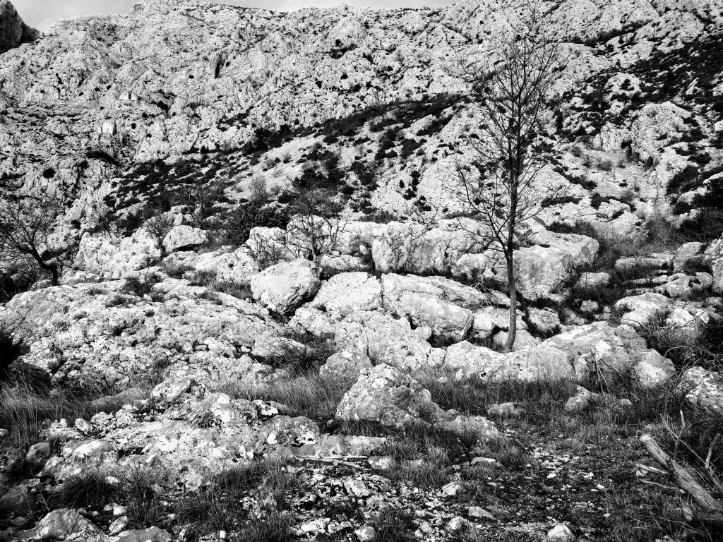
Podstup cave
Podstup is the closest of all the old Tučepi hamlets – only a short 15-minute walk from Tučepi. A small path on the west part of the circular road leads downhill to the stream where villagers used to take water.
The stream runs through a striking canyon with cliffs on both sides. Before you reach the water, a fortified cavern will grab your attention. According to the locals, the villagers used it to keep crops and livestock during and after the wars.
3 towers in Srida sela
Srida sela (Village centre) was the focal point of old Tučepi for thousands of years. It is no wonderthat it has three towers for protection.
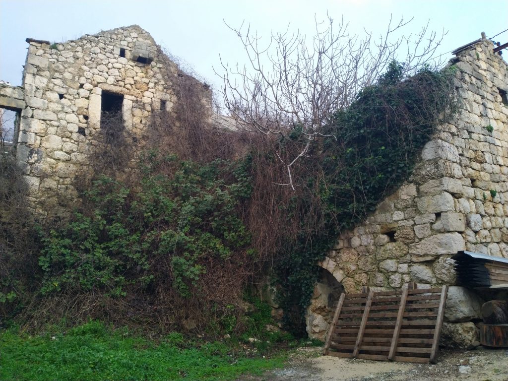
Lalić tower is the easiest to reach and the hardest to recognize, as it is fused with the surrounding houses. It was built in the 16th or 17th century as a freestanding tower. Shortly after, houses appeared on both sides, forming a little square that we can still see today. It is hard to tell where the tower begins, and the houses end, but the whole complex is an enchanting example of traditional construction.
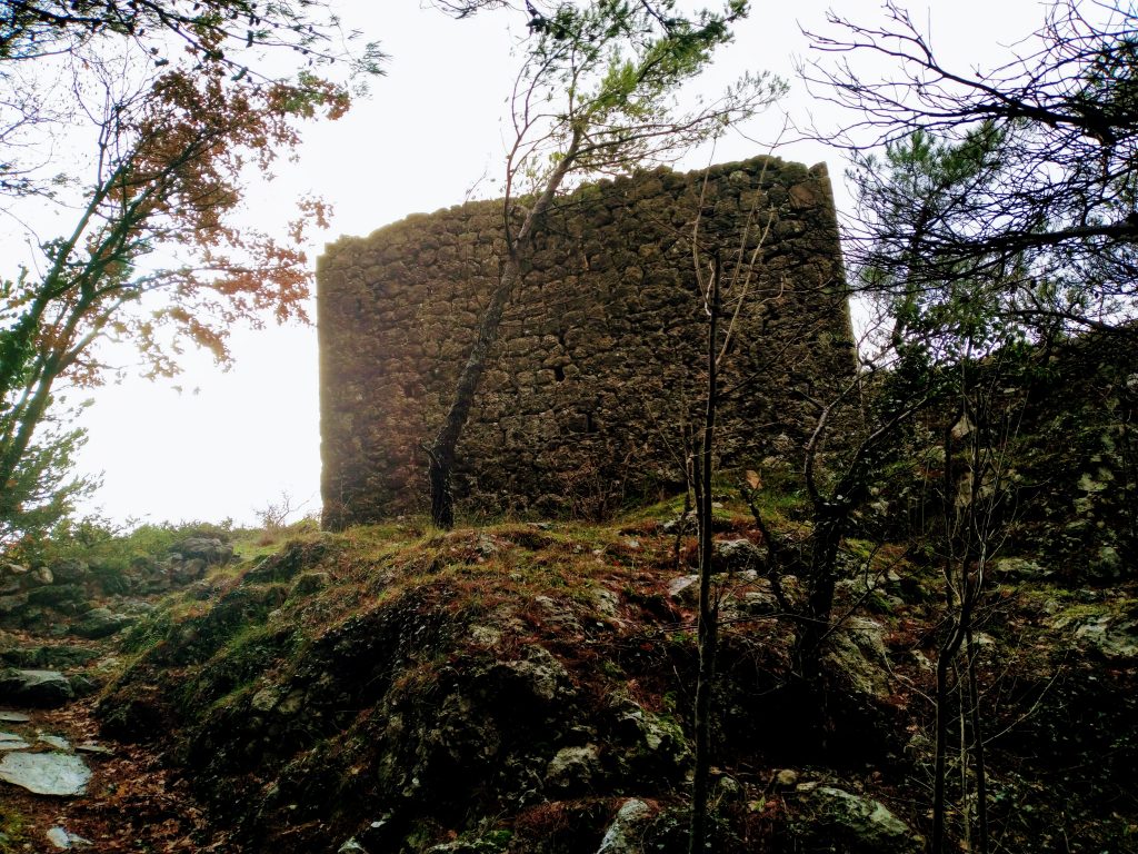
The Bušelić tower, built in the 17th-century, hides in the forest above the houses. The municipality of Tučepi has cleaned up the area around the tower. Its name is related to the story of Grgo Bušelić, a folk hero in the battles against the Ottoman. Unlike Lalić Tower, the path is well marked and is an easy 15-minute hike from the first tower.
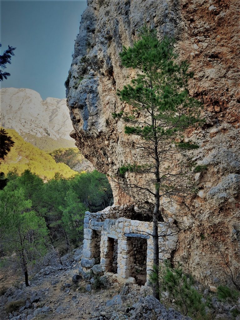
Reaching Šarić Tower requires more stamina and agility. A steep “goat trail” commences at the 16th-century church St.Kate and takes you to the tower – if you know where to go. It is situated on a somewhat inaccessible rock, so suitable footwear is essential. Halfway to the tower, you should stumble upon the remnants of St.Martin, an early Romanic church. Both are hard to find due to the lack of demarcation – it would be best if you spoke to a local before you decide to find it.
Crvene stine (Red rocks) in Podpeć
A pleasant forest road starts at St.Kate and leads to Veliko Brdo above Makarska. The beautiful scenic route at the foot of the mountain will reveal several historical and natural gems. The first step is Podpeć, the hamlet on the highest altitude in old Tučepi.
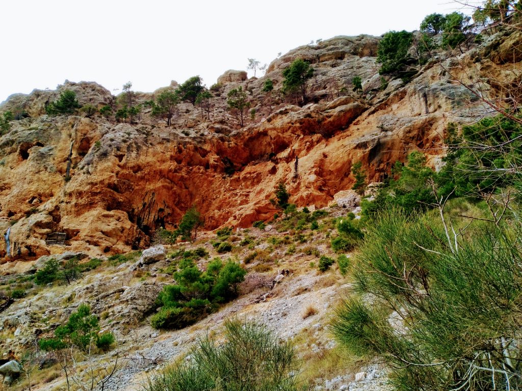
The name means “Below the cave”, referring to the several caverns above the village – including the rock formation known as the Red rocks, an impressive cavern complex the locals built to store crops. The formation is visible from Podpeć, yet entirely cloaked when looking from Tučepi.
The caverns are high up and require some climbing skills and suitable footwear. Follow the official mountain trail leading to Logorišća voda and Lađena which starts at the settlement Grubišići.
The Kotišina castle
In a small isolated forest 10 minutes after Podpeć, before the road to Kotišina turns to the Makarska area, you will find the destroyed hamlet of Marasi. Shells of stone houses assimilated by nature are not unusual in the villages, but the homes in Marasi are not just merged with ivy and vines, but with living mountain rock. Stone houses, long abandoned by man, slowly merge with the mountain.
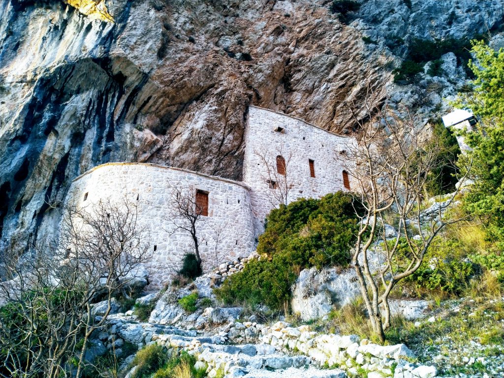
Forty minutes of easy hiking later, after passing the church of St.Ante (Anthony), a more densely populated area of Makarska will appear beneath you. Kotišina, home not only to the biggest fortification of our historical hike but also to the botanical garden, which contains plant species endemic to the area.
The castle planted in rock dominates the whole valley. Constructed during the War of Candia (1645 -1669) it also served as a shelter for the inhabitants of Makarska. In 2020, the city renovated the castle into a five-storey interactive museum.
Turkish caves in Makar
Another 40-minute hike will take you to Makar, a hamlet on a hill with a stunning view of Makarska. Makar gave Makarska its name, and also has an intimate relationship with the mountain.
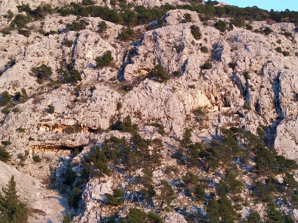
Before you reach the cemetery in Makar, turn around and take a look at the mountain. You will see three fortified caves above the houses.
What makes the three Makar caves different is their altitude and inaccessibility. To reach them, one needs to have excellent climbing skills and suitable footwear – and a rope for the highest one. The people of Makar would most probably use a ladder to climb and pull it up with them, to prevent the attacker from doing the same.
The region of Makarska Riviera has a rich history due to its strategic position. Destined to be on the frontiers of empires and kingdoms, the locals understood the importance of forts. The most important ones – other than Tučepi and Makarska – can be found in Igrane, Podaca and Drvenik, but we will tell their story another time.